
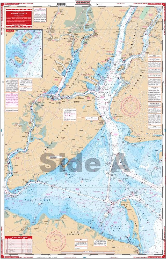
Standard Navigation, 62 New York Harbor
Product details
| Management number | 228134017 | Release Date | 2026/05/31 | List Price | US$15.60 | Model Number | 228134017 | ||
|---|---|---|---|---|---|---|---|---|---|
| Category | |||||||||
The best chart for the New York City area combining information from five government charts! Covers Sandy Hook Bay, the entire Lower Bay and Raritan Bay, Staten Island, Brooklyn, Jersey City, Newark, and lower Manhattan on one side. The reverse side covers the East River through Hell Gate and out past Rikers Island, under the Throgs Neck Bridge to Kings Point, as well as the Harlem River north to the Hudson. Colored key and panel designations and large print place names make this chart easy to use. Information from 5 NOAA Charts: #12342, #12366, #12327, #12334 and #12339. Chart is 25" X 38". WGS84 - World Mercator Datum.
- Two Sided
- Foldable
- Tear Resistant Synthetic Paper (Hop-Syn) 5 PP Tree Friendly
| UPC | 740399006206 |
|---|---|
| ASIN | B0014471EE |
| Brand Name | Waterproof Charts |
| Part Number | 62 |
| Manufacturer | Waterproof Charts |
| Item Dimensions L x W | 25"L x 38"W |

Bestseller ranking
Charts & Maps


Correction of product information
If you notice any omissions or errors in the product information on this page, please use the correction request form below.
Correction Request Form